


Business Sectors
Business Sectors
Events
Contents
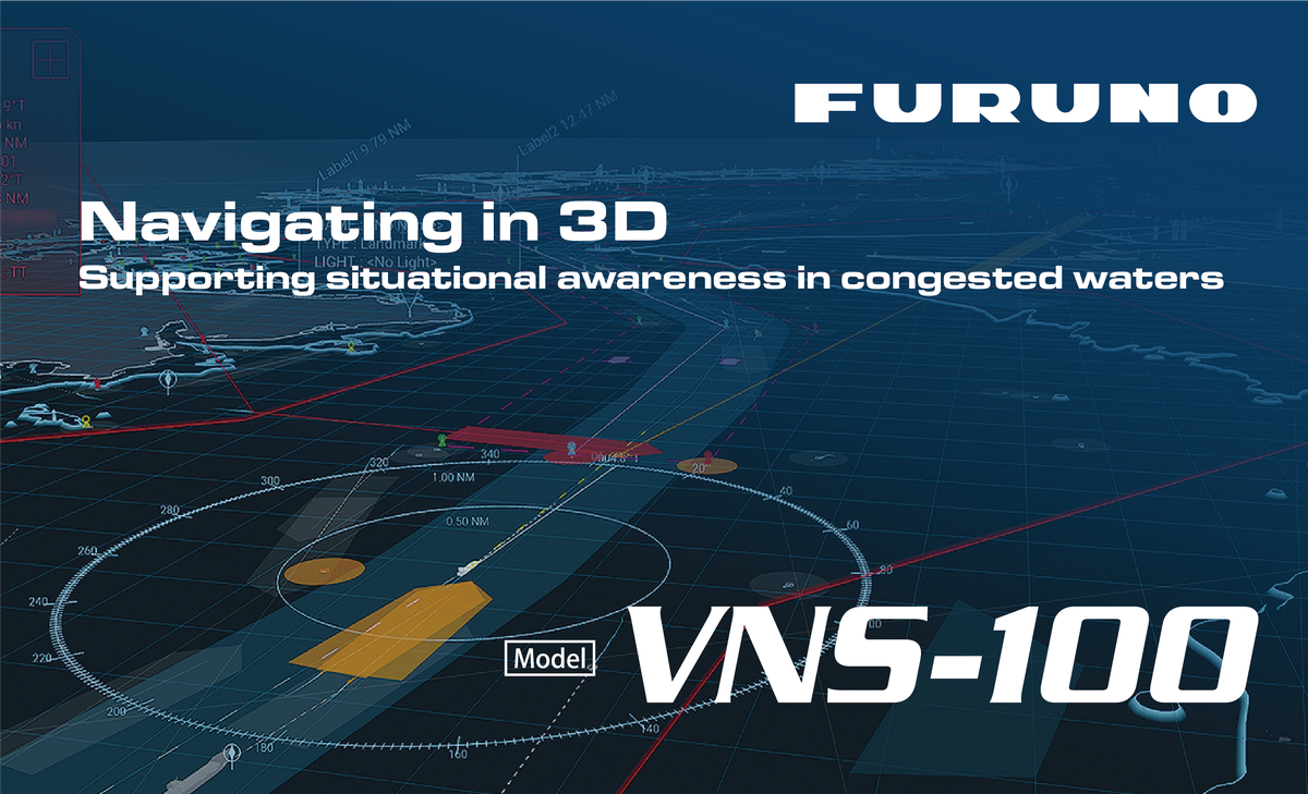
VNS-100: Advanced 3D Navigation for Safer Decisions
The VNS-100 is an advanced VR Navigation System designed to enhance situational awareness and support navigational decision-making.


Advanced 3D Navigation Support
By integrating chart data, Radar targets, AIS information and collision risk visualization into an intuitive 3D environment, the system helps navigators quickly understand complex traffic situations, particularly in congested waters.
Modern bridge teams are required to process large amounts of navigational information simultaneously. The VNS-100 transforms this information into a clear visual representation that can make the surrounding traffic situation easier to interpret. Instead of relying only on conventional displays, navigators can use a three-dimensional view to gain an additional perspective of vessels, traffic movements and the navigational environment.
Key Features
Bird View
The Bird View function provides flexible 3D visualization of surrounding traffic and navigational information. This perspective gives navigators an overview of the situation around the vessel and can help them understand the relative positions and movements of surrounding targets.
Fully Automatic Acquisition and Tracking
The VNS-100 automatically acquires and tracks Radar targets, helping reduce the risk of overlooking vessels. Automatic target acquisition and tracking support the bridge team by continuously presenting relevant traffic information and reducing the need to manually monitor individual targets.
Risk Visualizer™
The Risk Visualizer™ provides an intuitive visual representation of collision risk using color coding. By making potential risk situations easier to identify, it supports navigators when assessing traffic conditions and considering safer maneuvering decisions
Supporting the Next Generation of Navigators
The VNS-100 is also designed to support the development of shared situational awareness within bridge teams. By presenting complex navigational information in a clear and intuitive visual environment, it can help bridge team members develop a common understanding of the situation around the vessel.
This visual approach can also support training and knowledge transfer. Navigational situations can be easier to explain, discuss and communicate when the relevant information is presented in an accessible three-dimensional format. For experienced navigators as well as those developing their skills, this can contribute to a better understanding of complex traffic situations and decision-making processes.
The system therefore combines navigational information, target tracking and risk visualization in one environment. Its purpose is to help bridge teams interpret their surroundings, communicate more effectively and support safer navigational decisions.
To learn more about FURUNO Marine DX and the VNS-100, visit the website below.
www.furuno.com/en/merchant/marine-dx/autonomous/index.html


Related to this Story
Events

© 2026 Riviera Maritime Media Ltd.


