


Business Sectors
Business Sectors
Events
Contents

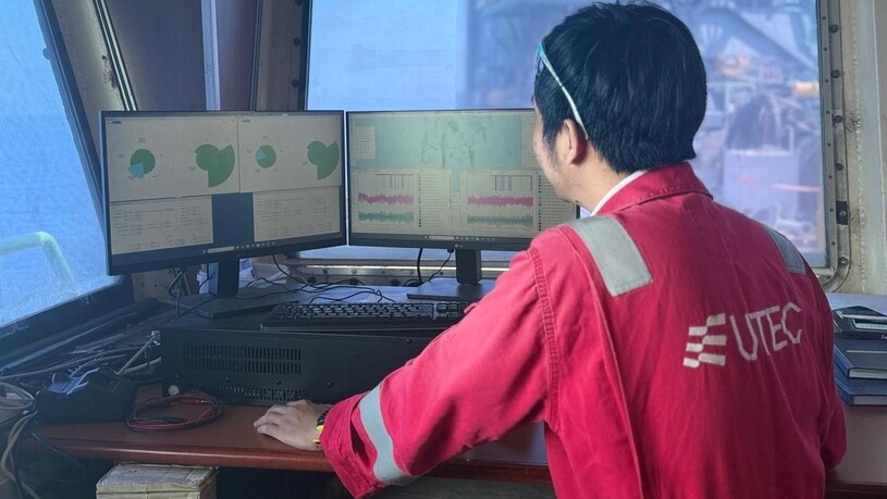
UTEC unveils resilient positioning solution to address growing GNSS disruption risk
UTEC, Acteon’ geo-services business line, has developed a hybrid acoustic-inertial positioning system that operators can use to combat spoofing


The new solution enables offshore construction operations to continue safely and accurately in environments affected by global navigation satellite system (GNSS) disruption.
In the Middle East, offshore operators are increasingly encountering challenges associated with GNSS interference, denial and spoofing. Accurate positioning is critical to the safe and efficient execution of many offshore operations, with GNSS serving as the primary positioning reference for many operators.
Where GNSS signals become unavailable or unreliable, the resulting loss of positioning accuracy can increase risk and affect project schedules. In the worst cases, vessels may be restricted to anchorage until a suitable alternative positioning system is in place. Recent geopolitical instability has reinforced the need for resilient positioning systems in regions where GNSS disruption is becoming an operational reality.
Recognising the growing challenge, UTEC developed a solution capable of operating independently of GNSS. By combining its offshore operational expertise with Sonardyne’s technology and software, UTEC developed a hybrid acoustic–inertial positioning system that enables operators to maintain accurate navigation even when GNSS signals are disrupted or unreliable. When GNSS is available, operators can use it alongside the inertial positioning system and benefit from both.
The system is now supporting two Middle East pipelaying projects covering more than 150 km of pipeline installation. UTEC collaborated with Sonardyne and the project operator to validate the solution and demonstrate its suitability for offshore construction operations in GNSS-disrupted environments.
By providing an approved alternative positioning capability, the system enabled continued offshore operations in circumstances where vessel activities may otherwise have been restricted or forced to stop.
UTEC vice president Asia Pacific and Middle East Nadir Rahmatullah said, “We recognised early on that GNSS disruption was becoming a growing operational consideration for offshore operators and wanted to ensure our clients had a proven alternative positioning system.
“While currently supporting pipelaying operations, the system has significant potential across a range of offshore construction projects where resilient, independent positioning capabilities are vital.”



Related to this Story


Events

Maritime Regulations Webinar Week
 16 Dec 2025
 GMT - ONLINE
Floating energy: successfully unlocking stranded gas using FLNGs and FSRUs
24 Feb 2026GMT - ONLINE
© 2026 Riviera Maritime Media Ltd.


