Business Sectors
Events
Contents
Voyage management and vessel tracking
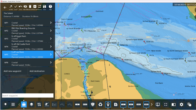
Program suppliers have upgraded software that fleet managers can use for tracking vessels and calculating more efficient voyages. Pole Star Space Applications has released a new version of its Fleet Management (FM) 2.0 web-based, ship tracking software. Chief technology officer Peter Davies said the program has a new user interface, enhancements to existing features and additional ones.
There are new map options that are in addition to the original C-Map charts, and enhanced weather graphics provided by TideTech. The weather graphics can be overlaid over the map to provide situational awareness for planning and operations. Pole Star has also added a quick search feature, which allows users to search for a vessel and automatically locate it on the map or fleet list.
The new interface has been designed around the HTML5 mark-up language, enabling it to be used on mobile devices, such as smartphones, tablets and laptops. This means the application is automatically optimised for the device’s screen size and orientation. The first version of FM monitored ship position and movements using a ship’s Inmarsat-C or a dedicated Pole Star terminal. It is used to track more than 6,500 vessels.
Odfjell Tankers uses the original version of FM. Its manager of fleet performance Erik Hjortland is looking forward to using the new interface, “and to the benefits that mobile access will bring”. He added: “FM has helped us to improve operational efficiency and achieve cost savings by monitoring the vessel’s position and speed.”
Applied Weather Technology (AWT) has upgraded the way it calculates ship performance during voyages by adding tidal stream information. The company supplements the information within the Hybrid Co-ordinate Ocean Model (Hycom), which is used to calculate the ocean circulation, with tidal stream data.
AWT data manger and weather analyst Stephen Santilena said the program provides fleet managers and ship operators with the most comprehensive ocean circulation information available. “One of the many tools that AWT uses to evaluate and optimise ship performance is ocean current data provided by National Oceanic and Atmospheric Administration’s Real Time Ocean Forecast System. This system uses Hycom information, but this does not incorporate the effect of tides on its ocean circulation output.”
Over the open sea the tidal influence is minimal. However, near many straits, coastal channels and ports the tides can be the dominant force on sea circulation, and therefore affect ship performance. AWT’s full tidal model consists of 22 separate domains of varying resolution that can be used to calculate the tidal current and tidal height at any water point in the world, Mr Santilena explained.
“We incorporate output from all of these domains to produce a global 1/12 x 1/12 degree resolution data set. We then add this global tidal data set to the modelled Hycom ocean circulation data. The resulting output is a global ocean current data set that shows the large-scale circulation, as well as the tidal influences in smaller coastal regions. Having this tidal data helps in predicting strong, short-lived currents that could affect a ship’s performance when transiting in and around areas where the tidal influences are strong.”
An example of this is in the Bay of Fundy, between New Brunswick and Nova Scotia, which has the world’s largest tidal range, at 17m. The bay has strong currents that have a direct impact on ship performance.
“We expect that future versions of Hycom will include the tidal influence in the model output,” Mr Santilena said. “Until then, we will continue to supplement the model output with AWT-calculated tidal streams in order to provide our clients with the most comprehensive ocean circulation information available.”
AWT has introduced a voyage calculator program that provides information on the distance, speed loss and corresponding cost of a voyage from one port to another, taking into account weather, ocean currents, hire rates and other factors. The program uses AWT’s Climatological Ship Resistance model and accounts for the different fuels used and rates of consumption. It can also factor in emission control area zones and piracy considerations as it plans a route.
AWT is partnering with KVH Industries to deliver its BonVoyage weather data via the IP-MobileCast WeatherLink service. Weather forecasts will be sent to ships over the mini-VSAT Broadband network. The WeatherLink service will be tested in July and should be commercially available in September. Ships with TracPhoneTM V-IP series of VSATs on board will support the BonVoyage weather content after a free over-the-air software upgrade. MEC
Related to this Story
Events
Maritime Environmental Protection Webinar Week
Cyber & Vessel Security Webinar Week
The illusion of safety: what we're getting wrong about crews, tech, and fatigue
Responsible Ship Recycling Forum 2025
© 2024 Riviera Maritime Media Ltd.
