Business Sectors
Events
Contents
Integrated technology streamlines voyage planning
Navigation support is becoming more integrated, with automation reducing workloads for bridge teams
Navigation support is becoming more integrated, with automation reducing workloads for bridge teams
Automated electronic navigational chart (ENCs) updates combined with weather, ocean data and passage planning advice allows officers to spend more time monitoring voyages and supervising ship operations.
New ECDIS products and updates were released in Q2 2019 to improve voyage planning, automated ENC management and safe navigation.
Navico subsidiary C-Map introduced version 2.1 of its integrated maritime suite (IMS) for navigational chart and publication management in June. This streamlines voyage planning and nautical information management with a new NauticalManager module enabling quantitative analysis of weather and navigational considerations for route planning.
C-Map IMS 2.1 has a weather routeing module to automatically generate proposed ship voyages within specified environmental limits, optimised for lower fuel consumption and emissions, and maintaining seakeeping limits. This is integrated into web-based FleetManager to provide information to shore managers.
IMS manages the onboard S-57/S-63 electronic chart portfolio, licences and updates for ECDIS with C-Map, UK Hydrographic Office (UKHO) and Primar ENCs. It overlays 19 weather parameters including ice cover and provides weather alerts. The passage plan report includes temporary and preliminary notices to mariners and preset route optimisation criteria. IMS also provides licence certificates and ENC holding reports on demand for port state control inspectors.
In July, ChartCo expanded its OneOcean digital solution with a fixed-price pay-as-you-sail (PAYS) package that involves shipowners paying only for the ENCs used on a voyage compared with purchasing licences on a regional or global basis.
The OneOcean platform includes ENCs, weather, regulatory information and nautical publications. It automatically updates ENCs with notices and, with PAYS, it provides owners with budgetary certainty on annual ENC costs.
OneOcean ensures ships remain compliant with all navigational and regulatory requirements during a voyage by providing Regs4ships information, which helps shore managers to identify and implement future changes. Regs4ships brings together flag state compliance documentation with IMO, ILO and EU legislation and is used by more than 6,000 vessels worldwide.
These numbers were strengthened in Q2 2019 when the entire Carnival Cruise Line fleet of 24 ships was added. ChartCo already supplied 75% of the Carnival Corp fleet, including Princess Cruises, Holland America, P&O Cruises, Costa, Aida, Cunard Line and Seabourn.
Regulatory compliance is a top priority for the group, says Carnival Cruise Line nautical manager Giuseppe Benincasa. “In today’s highly complex regulatory environment it made sense for us to begin using the solution across our entire fleet,” he says. “Regs4ships represents a smart, dependable, effortless and time-saving way to synchronise compliance across fleets and head offices.”
AI-driven route planning
During Q2 2019, ChartWorld introduced its MyRouteAppraisal (MyRA) platform for verifying ECDIS-ready voyage plans and partnered with Napa for artificial intelligence-driven route planning.
MyRA provides vessels and onshore personnel with automatically proposed voyage plans based on a route network, port databases, bathymetry from ENCs, weather forecasts and the relevant ship model. It factors in ship-specific safety contours and automatically calculates safety corridors. Routes can be checked and optimised to avoid inclement weather or minimise fuel consumption.
ChartWorld’s partnership with Napa includes MyRA modules to evaluate the operational efficiency of past voyages, and uses this data to optimise future transits.
Past voyages are automatically evaluated via ChartWorld’s route network datasets and analysed by Napa’s algorithms for operational efficiency, taking into account wave conditions, weather, and other factors that affect the voyage.
UKHO released a new feature for its Admiralty Vector Chart Service (AVCS) to provide shore-based managers with vessel tracking and voyage planning functionality. AVCS Online enables shore staff to access more than 15,000 ENCs which are updated weekly, digital information and approaches for 4,000 ports worldwide for vessel tracking and route planning.
AVCS Online can also be used to investigate accidents and emergency incidents.
It can be integrated into existing web-based systems as a standalone chart solution. Other information layers can be added on to ENCs to optimise planning and support onboard operations.
Nautical solutions
GNS uses Admiralty ENCs as part of its Voyager Navigation as a Service (VNaaS) product. This provides publications, digital and paper nautical charts at cost-price while its customers pay an annual software licence fee to access the complete set of software and data analytics tools. These can be used by offices and managers to reduce fuel consumption through better route planning.
GNS chief executive Paul Stanley says Voyager NaaS was developed to support the long-term partnerships the business has with shipping companies.
“It gives customers complete transparency about the price they are paying, the data analytics required to identify exactly the products their vessels need, and the software tools required,” he says.
Shipowners only need to purchase the charts and publications required for a passage. Software and analytics means purchases are tailored to these requirements, reducing overspending by managers.
Poseidon Navigation Services has developed its Challenger software to automatically update ENCs with weekly electronic safety and navigational information. This includes Admiralty AVCS, information overlays, digital publications and e-NP updates. Challenger has a route planner with a built in product catalogue, NavArea warnings and a web portal for tracking vessel ENC and digital publication inventories.
SevenCs is providing its Nautilus software development kit (SDK) kernel to develop TELKO’s new ECDIS units. This platform loads and displays ENCs in maritime and military chart formats. It fulfils the IMO, IHO and IEC requirements for type-approved bridge equipment. SevenCs is the world’s largest provider of these kernels with more than 30,000 licenses sold in the maritime and naval markets.
Hardware developed for machine interfaces
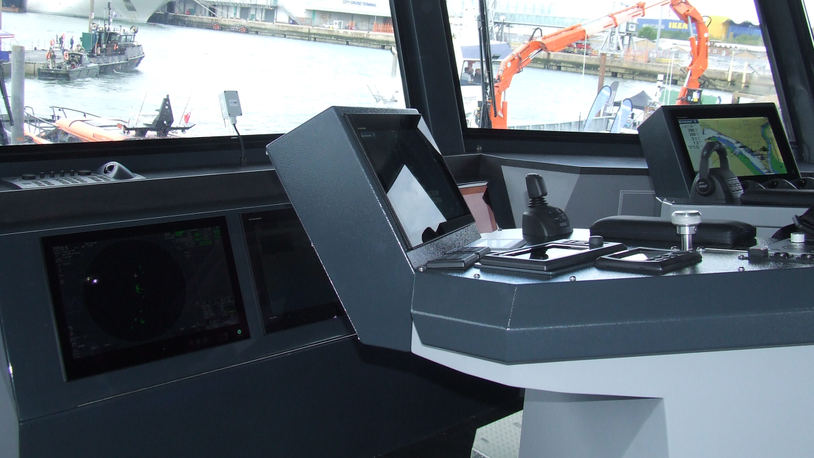
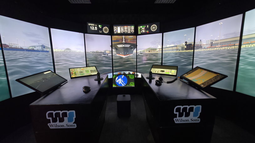
Smart navigation needs developments in human-machine interfaces in addition to the latest advances in software-driven products. Screen technology is essential for displaying optimised routes, weather information, radar and AIS.
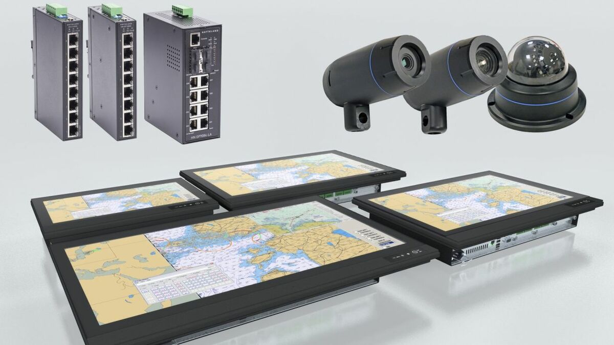
Hatteland Technology unveiled a portfolio of displays, controls and workstations in June. This included its new Series E panel computers for navigation applications with 15.6-in, 21.5-in, 24-in and 27-in screens for integration into bridge and control systems.
This series adds to Hatteland’s existing high-definition 4K displays, with 32-in, 43-in and 55-in screens. These can be supplied as consoles, wall-mounted displays, floor tilt or voyage planning chart tables and have projected capacitive touchscreen technology and sunlight-readable displays.
In June, Hatteland also launched its range of network-enabled security and surveillance IP cameras and energy-efficient network switches that connect several Ethernet devices simultaneously.
A new set of marine cameras was also introduced by Flir in June. M400 and M500 camera systems provide visibility of marine traffic, navigation aids, floating hazards and other targets in all conditions.
These have thermal imaging for night and day operations to improve hazard identification in darkness, bright sunlight, in smoke, dust and fog.
M400 and M500 have high definition cameras with low-light capabilities to detect hazards and threats at long-range. Flir’s cameras integrate with radar, AIS and ECDIS.
Navico introduced the Simrad P3007 and P2005 GPS series with colour 5-in or 7-in displays and intuitive touch control. These provide position, course, speed, time and navigation data to other bridge systems such as radar, ECDIS and autopilot.
Simrad P3007 GPS is IMO-approved for SOLAS vessels. It can be paired with high-precision antennas and configured for dynamic positioning or as a transmitting heading device. Simrad P2005 is designed for workboats and other non-SOLAS vessels.
Both display vessel position and heading, routes, waypoints, AIS and voyage log. They connect to GPS and Glonass satellites for accurate positioning.
Related to this Story
Events
Offshore Support Journal Conference, Americas 2025
LNG Shipping & Terminals Conference 2025
Vessel Optimisation Webinar Week
© 2024 Riviera Maritime Media Ltd.
