Business Sectors
Events
Contents
Navtor launches auto-routeing module for digital chart table
Norway-headquartered maritime navigational technology provider Navtor says the concept has been under development for nearly a decade
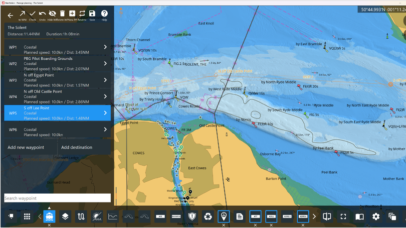
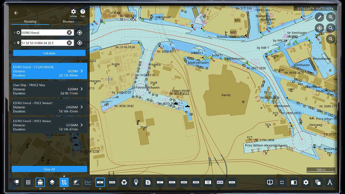
Navtor has launched an advanced auto-routeing module to its NavStation digital chart table the company said will significantly reduce manual, administrative tasks for navigators.
The tool will, according to the company, be the first to enable bridge officers to calculate routes both from port to port, as well as from point to point, with the calculations done within the application. Detailed routes can be refined for the precise needs of individual vessels and voyages, are instantly available and can be seamlessly updated, compared and shared, Navtor said.
“Everything is done with a just a few clicks, in a matter of seconds, with all the critical data layers on NavStation ensuring complete compliance and control – both for vessel teams and, through our integrated e-Navigation ecosystem, onshore management," said Navtor nautical advisor Johan Stensaker.
According to Navtor, the module works by providing the shortest routes from port to port, waypoint to waypoint, current vessel location to ports, "or from any given point to the huge majority of piers and berths in most major ports". Routes can be altered or compared and adjusted for variables such as water depth and additional ports of call. All restricted areas, traffic separation schemes and other key criteria are taken into account, Navtor said.
"It is an easy-to-use, comprehensive, flexible, day-to-day tool that, we believe, is a ‘line in the sand’ in terms of how officers plan, decide upon and execute routes," Navtor chief executive Tor Svanes said.
The auto-routeing module is available as a subscription service on NavStation, along with other layers including port data, AMVER reporting and weather routeing, among others.
Riviera Maritime Media will provide free technical and operational webinars in 2022. Sign up to attend on our events page
Related to this Story
Events
Maritime Environmental Protection Webinar Week
Cyber & Vessel Security Webinar Week
The illusion of safety: what we're getting wrong about crews, tech, and fatigue
Responsible Ship Recycling Forum 2025
© 2024 Riviera Maritime Media Ltd.
