Business Sectors
Contents
Register to read more articles.
Navigation buoys trialled for US waterways communications
Digital inland navigation buoys could expand communications networks along rivers and shipping waterways if tests in the US are successful
The US Army Engineers (USACE) is testing final prototypes on a 16-km stretch of the Ohio River around the Louisville District after earlier trials on the Occoquan River in Virginia.
The next step is to undertake a large field trial of the technology using towboats, barges and other inland vessels receiving communications from these navigation buoys.
USACE said the 12,000 inland buoys along US waterways could be repurposed or replaced with patented technology to communicate navigation and safety information to shipping.
Vessels transporting more than 280M tonnes of goods, mostly grain and petroleum products, along these waterways rely on these buoys for marine navigation, making them ideal communications hubs.
USACE, through its ERDC research and development centre and Geospatial Research Laboratory (GRL), is planning to build an extensive inland waterways network. This mesh network would provide a solution where there is a communications gap not covered by existing networks or cellular connectivity.
“There are gaps in the ability to get information. This network could push important navigation information to the mariners along the entire waterway, not just around the locks and dam locations,” said GRL technical director Austin Davis.
“This would provide a way to get maritime information – which is important to navigation safety – to the people who need it.”
This technology will be tested in a phased approach to developing a national programme of digital buoy investment.
“The ultimate goal is trying to be a stepping stone to start converting navigation on the rivers to a virtual buoys system, but that is several decades away,” said Mr Davis.
“The next step would be a large field trial. We have to prove the reliability of the technology. This is about how you make the aids to navigation a little bit smarter and give them more capabilities.”
He said a large field trial would seek to answer questions about how to augment a US Coast Guard (USCG) buoy best, whether the system can be stretched over one river or multiple rivers, as well as questions about power, reliability, durability and costs.
“In the laboratory effort, we have provided a proof of concept, but there are a lot of things not considered in that effort,” Mr Davis said. But if a larger field test proves successful, “if it makes sense, we could scale it into a national digital buoy system.”
USACE is responsible for planning and constructing improvements to inland water navigation and dredging and maintaining thousands of miles of inland waterways.
“This system of maritime aids to navigation provides the lane markers, street signs and stop lights for the nautical rules of the water,” said USACE computer scientist Tung Ly, who developed the communications technology.
Digital buoys were developed in conjunction with the inland electronic navigational charts programme and USACE Louisville District. This technology was first targeted at providing USCG with the real-time location of its buoys. The idea has now grown beyond that.
“The real value to USACE is there would be a network that could disseminate navigation information by augmenting the USCG buoy,” Mr Davis said. “At the same time, this would provide trackability to where buoys are and how they move in the waterway. They do not sit still.”
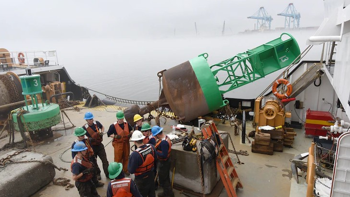
USCG and USACE vessels are used to install navigation buoys and test the new communications technology.
Sign up for Riviera’s series of technical and operational webinars and conferences in 2023:
- Register to attend by visiting our events page.
- Watch recordings from all of our webinars in the webinar library.
Related to this Story
Events
International Bulk Shipping Conference 2025
Tankers 2030 Conference
Maritime Navigation Innovation Webinar Week
© 2024 Riviera Maritime Media Ltd.

